I find myself regularly on US-441. It's just one of those routes that shows up whether I'm heading south toward Belleview or cutting over toward Santos. After living here for a number of years, I noticed something off in the median, hidden in the trees. If you look closely, big concrete structures peek above the tree line, just sort of standing there. No context, no obvious purpose. Just looming out of the forest like giants in the jungle.
I finally decided to go find out what they were.
This past weekend I parked at the Santos Trailhead and picked up the Florida Trail heading east. The idea was simple: hike until I could see what they were. The trail is easy, wooded, pleasant. The Florida Trail through this section winds through pine and oak with Spanish moss doing its usual work overhead. Nice walk. But I wasn't here for the walk.
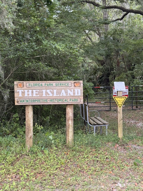
After a bit, I found myself standing in front of a wooden sign that read: Florida Park Service, The Island, An Interpretive-Historical Park.
A park. In the median of a highway. I had no idea this existed.
Inside the island
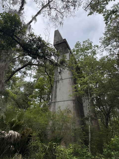
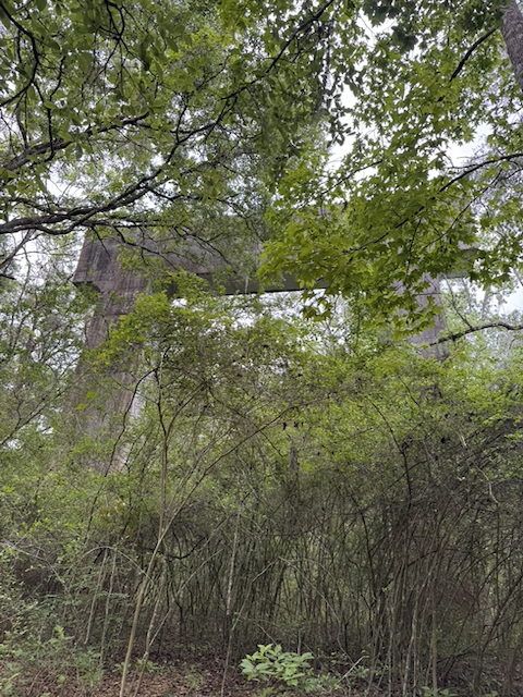
The best way I can describe the experience of being inside The Island is this: imagine Jurassic Park, but the dinosaurs are giant concrete structures. The forest is dense and tropical and full of sound, and then these massive structures just appear through the trees. They don't announce themselves. You're walking a trail one moment and then you're standing at the base of something that must be eight or ten stories tall, poured concrete, slightly mossy, rebar bristling from the top like it was interrupted mid-thought.
When you walk away from them, they disappear almost immediately. The canopy takes them back. A few steps and you'd never know they were there.
That contrast, the scale of these things against how completely the forest has reclaimed the space around them, is something a photograph doesn't quite capture. You have to be standing there, looking up.
What they were
The answer turns out to be one of the stranger chapters in Florida history. These are the bridge stanchions from the original Cross Florida Ship Canal, built in 1936. Construction started in 1935 as a Depression-era federal jobs program, a plan to cut a canal straight across the Florida peninsula so ships wouldn't have to sail all the way around the Keys. It stopped a year later. Picked back up in 1964 as the Cross Florida Barge Canal. Halted again in 1969. Permanently decommissioned in 1971.
The dream of a Florida canal goes back further than that, though. Apparently Philip II of Spain floated the idea back in 1567. Florida has been frustrating ambitious infrastructure projects for nearly five centuries.
What stopped the modern effort for good was a biologist from Micanopy named Marjorie Harris Carr. She co-founded Florida Defenders of the Environment and led the opposition that finally killed the canal, arguing, correctly, that it would devastate the Floridan Aquifer and destroy the springs that define this part of the state. She won. The land acquired for the canal was eventually designated a recreation and conservation area, renamed the Marjorie Harris Carr Cross Florida Greenway in 1998, the year after she died at 82. The woman who stopped the canal got the canal named after her.
The four concrete towers in Santos, built in 1936 and never used for anything, now stand inside The Island as the centerpiece of a short interpretive trail with kiosks and historical boards telling the whole story.
Older scars
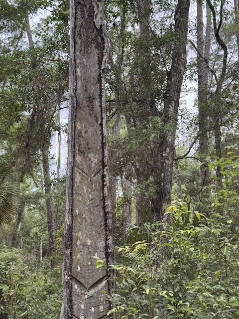
Another interesting thing I found on the trail wasn't the concrete at all. It was a pine tree. Or more specifically, what someone had done to a pine tree a long time ago.
The bark was carved with a long series of V-shaped cuts, stacked up the trunk in a chevron pattern called a catface, and it's the signature of turpentine harvesting. Workers would cut those gutters into the living pine to channel resin down into a collection cup. It was a major Florida industry through the late 1800s and into the early twentieth century, and those scars can persist on trees for well over a hundred years.
So in one small patch of median forest, you've got the ghost of two different failed industrial ambitions: a turpentine trade that eventually dried up, and a canal that never got finished. The trees are still standing.
The trail itself is short, about a mile round-trip in ten acres of thick forest, easy terrain, free to access. Parking is at the Santos Trailhead off 441, and from there it's a pleasant hike along the Florida Trail to reach it.
If you've driven US-441 and wondered why this median is here, or noticed those structures the way I did, now you know. Go see them up close. The forest context makes all the difference.

Written by
UI developer and federal design-systems engineer in Florida. I build accessible interfaces for federal health infrastructure and the open web.
Keep reading
All writing